


#213 Ethan Pond Campsite to Mizpah Hut - Day 134: ATMM 1844.7 to ATMM 1854.0
This cliff is a good place to stop and reflect, as I look back over the landscape from which I’ve traveled. Never Forget!
9-11-2024
It’s another beautiful morning.
Have you noticed that I’ve not had to walk in rain once on this trip yet despite it being day thirteen? It has rained several times over night, which is the perfect atmosphere for sleeping, but not once during the day.
Last night was a beautiful night to be in a tent. The only disruption was when a bear walked through camp late in the night. Hikers know the sound of those heavy footsteps, even in our sleep, and naturally awaken, to listen attentively, with ears like radars, to hear where it is, where it’s going, and what it is getting into.
This late-night visitor wasn’t loud or disruptive, just passing through, unlike the story I heard from another hike of this same night, in one of the other campgrounds, where a bear came in and flipped over one of the bear boxes.
I stop on my way back to the trail to look out over the water of Ethan Pond, scanning the horizon in hopes of seeing a moose, but find none.


It’s a mostly easy and enjoyable two-thousand-foot hike down the mountain from the campground to Crawford Notch / US 302. The only problem here for a hiker is constantly wondering if you're still on trail or not due to the lack of white blazes and trail intersections.
Trail maintenance crews have built steps near bottom half mile of the trail near Willey Station Road Trailhead to assist tourist who want to hike to the Ripley Falls.
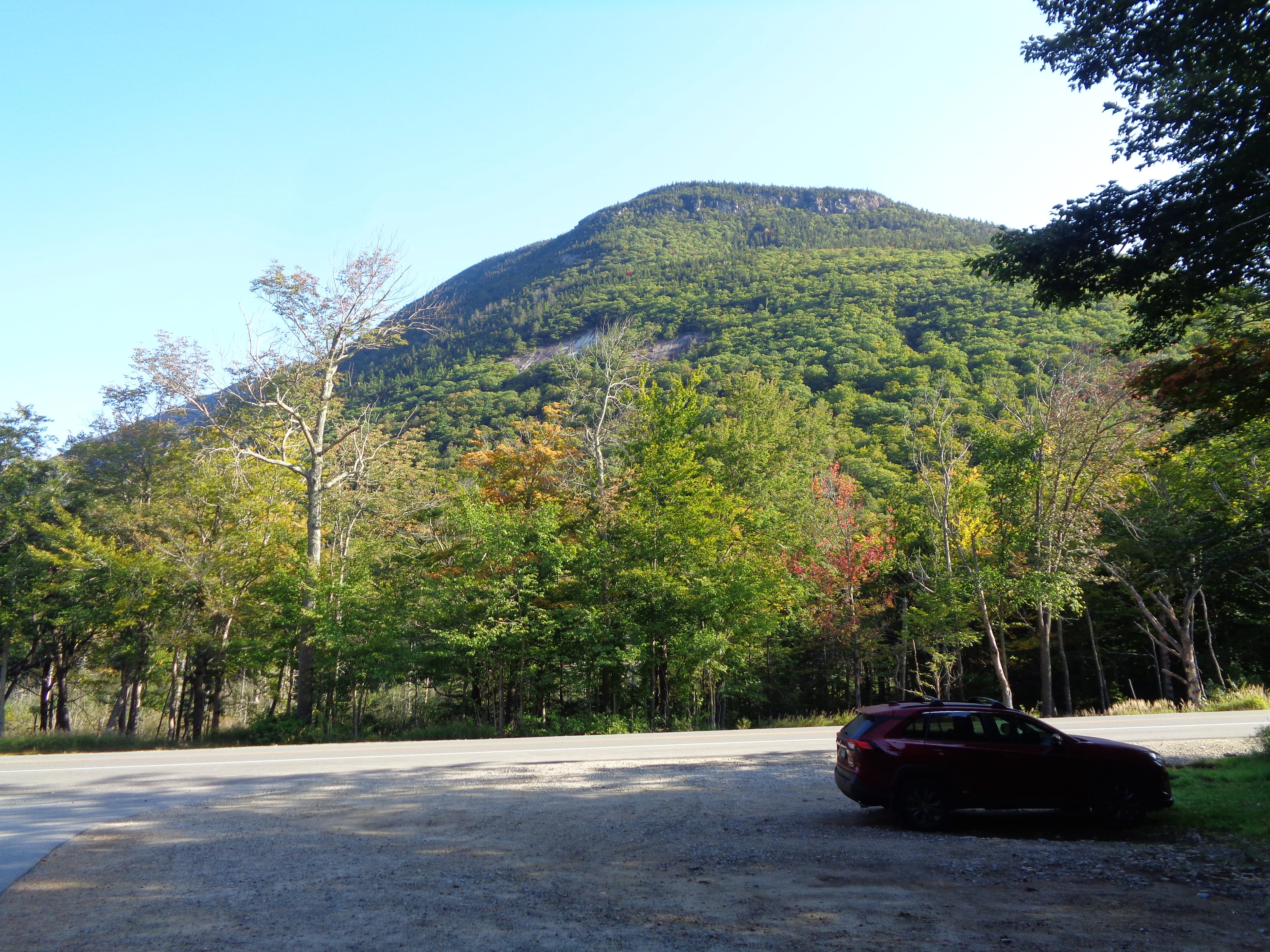
Crossing the Railroad tracks and entering the trailhead parking lot I look up to see a clear view of Mt. Webster, standing nearly three thousand feet above me (five thousand feet above sea level), with its brown exposed rock face looking down on me, taunting me, inviting me, almost challenging me to come up.
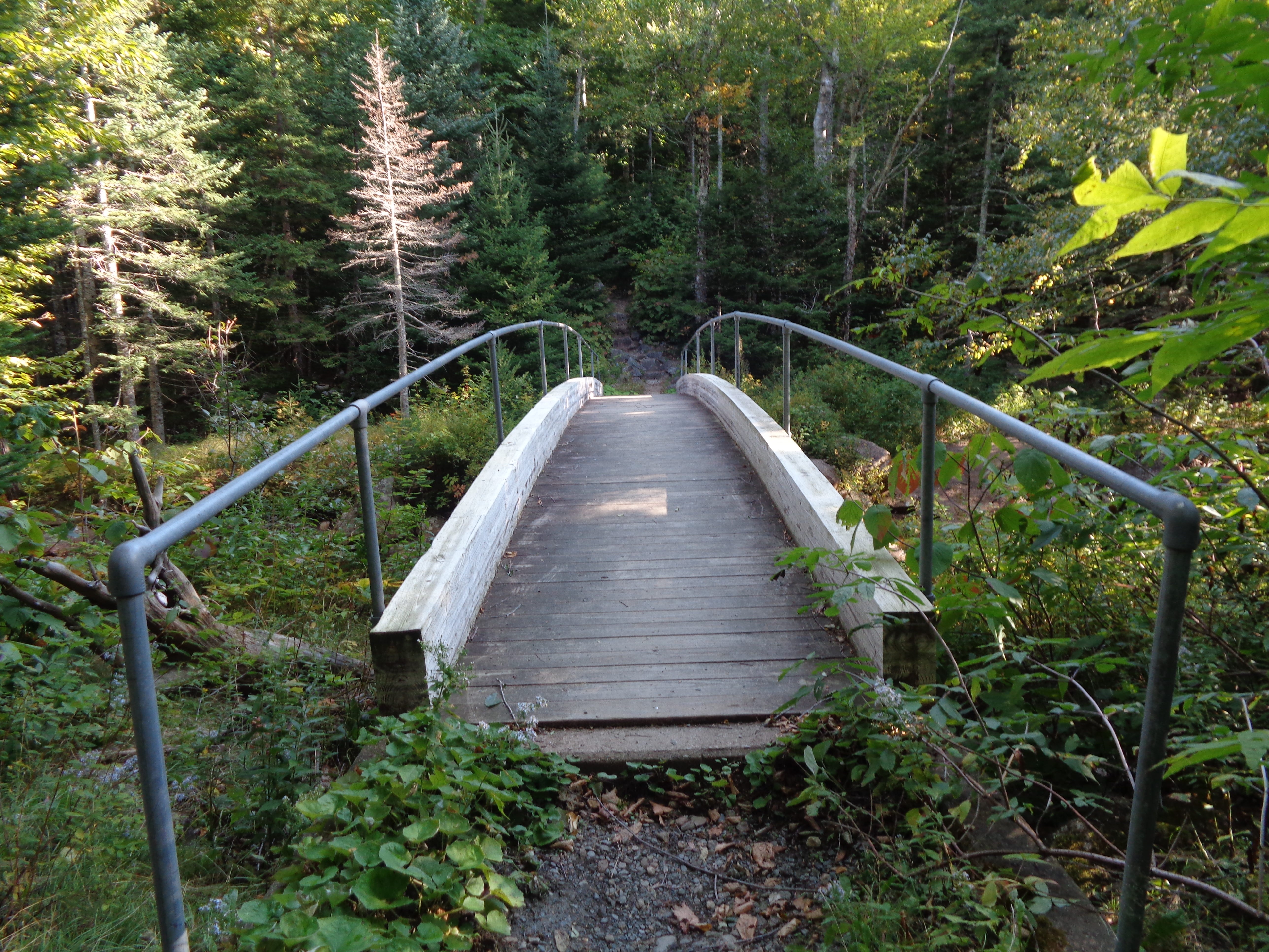
I cross US 302 (Franconia Notch Road) into the trees, across the footbridge over the Soco River, then and begin hiking up the steep mountain.
This section of trail is reminiscent of climbing mountains in the Smokies way back in North Carolina and Tennessee, like being transported back, fifteen hundred miles and seven years ago - our fore-Sprawlers set forth a new……… oh, sorry.
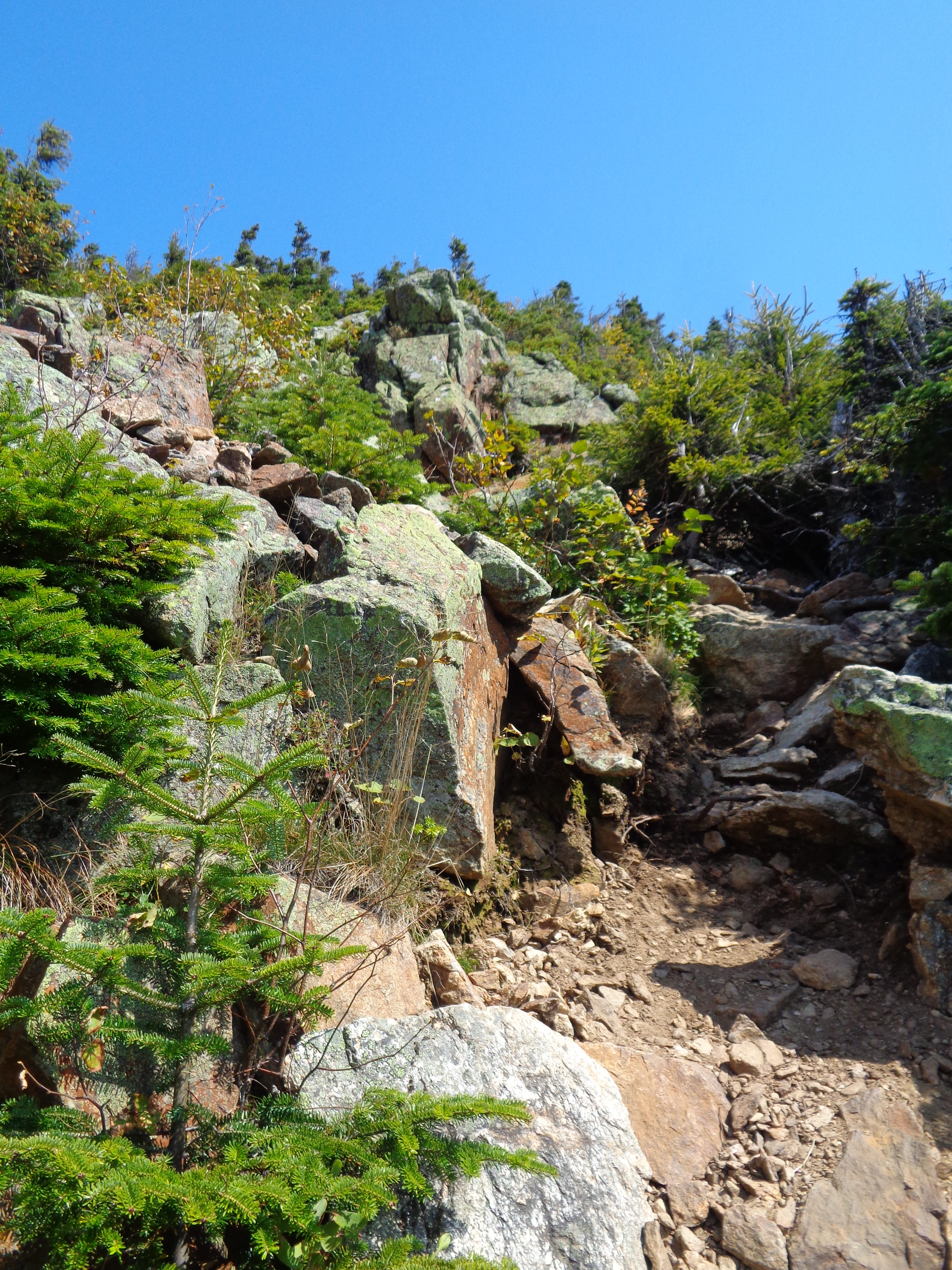
Higher and higher up the steep and rocky trail I climb, periodically taking short breathing breaks. It’s never a good idea for me to stop very long on a climb - if the muscles become too relaxed it’s difficult and sometimes painful to start again.
Fir trees are a sure indication you’re in New Hampshire, as is the lack of white blazes on these borrowed trails. The air once again smells like Christmas, the trail smells of (at least one) lost hiker.
I lose the trail a few times, even with the (lack of) help of the FarOut app. I’m not complaining; if I’m to get lost, there’s no lusher, deeper green, and more beautiful spot way up here to do so.
There are several places along Webster Cliffs where the trail meanders out to the edge. I’m near the first in the series but just can’t seem to get to it.
Ahh! There it is.
I have to guess which direction to go since there’s not a blaze to be found here to guide me. This looks and feels right, so I’ll go this way.
Yep, this is right. I strap my poles to the pack and begin hard hand over hard climbing, with certain injury if you were to fall, that is, if you don’t fall off the mountain all together.
On a large, exposed cliff I lose the trail once more, though I suspect it runs right up that dangerous looking route right over there.
I drop my pack and pull off my sweatshirt and boots for a long break. I’m wiped out and need to refuel. I also need to figure out where to go, though I know starting again will be difficult. So I’ll just hang right here in the warm sun and look out over this high cliff.
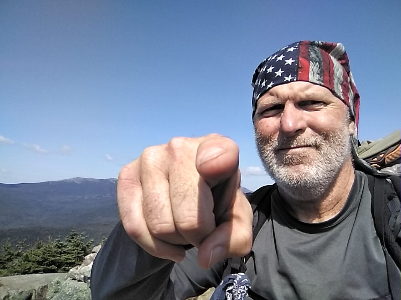
Today is September 11th, 2024. We used to say, “Never Forget,” but unfortunately, so many of us have. Some have never known. A whole generation has been raised who either wasn’t around yet or was too small to remember. A generation of older folks have passed on.
That day never escapes me. I still tear up when I remember too much. No, I wasn’t directly affected in that I wasn’t there or knew any of those who died, but as an American it cut into me then and cuts into me now.
This cliff is a good place to stop and reflect, as I look back over the landscape from which I’ve traveled.
Never Forget!


Gravy comes over the ridge huffing and puffing. He asks if I know where the route goes. I point to the nightmare behind me and tell him I think it goes up there.
He takes my place on a rock as I begin climbing. As I cross the ridge, I look back from each open face to see him still resting, growing smaller each time, waving back at me.


I meet a couple from France on the summit of Mt. Jackson. They hiked up here by way of one of the easier routs. The wife notices my empty water bottles and reaches in her day pack and pulls out a 4000ft IPA and hands it to me. The husband tells me about his hike on the Camino de Santiago and asks questions about life on the Appalachian Trail for long distance hikers.
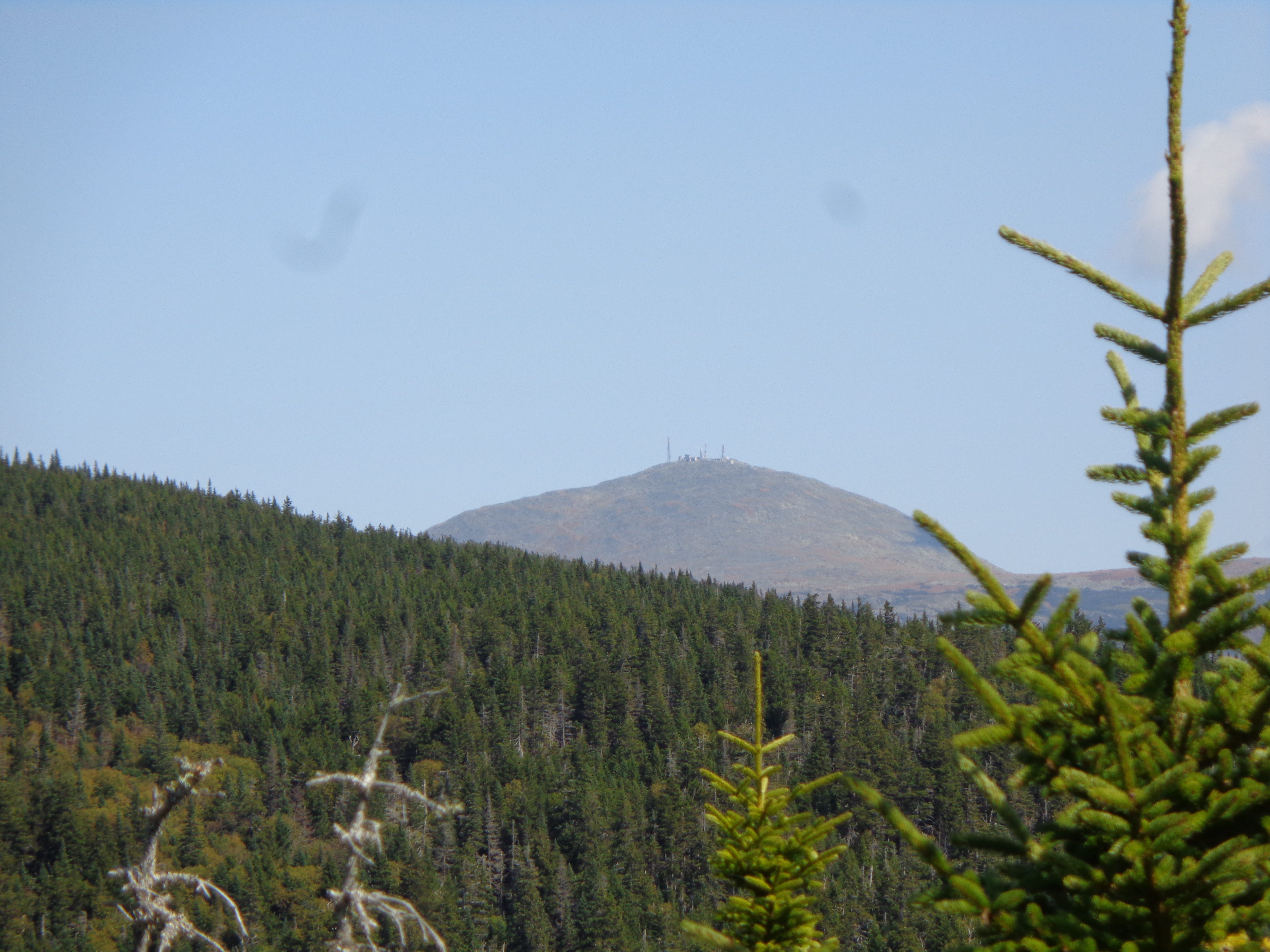
From up here I can see the summit of Mt Washington. I zoom in with my camera and can see in more detail the weather station on top.
I highly recommend those who’ve yet to subscribe to the paid side do so - tonight we’ll get a hands-on look into hut-life for a long-distance hiker. Only $5.00 monthly.